Scott's Bluff National Monument is a huge rock formation that was a major navigation landmark for the westbound Oregon Trail settlers in the 1840s.. Fur traders mapped it decades earlier and it was named for fur trader Hiram Scott who died near the bluff in 1828. Missionaries and military expeditions also passed by here in the 1820s. The spot marks the place where the great plains give way to the foothills of the Rocky Mountains.
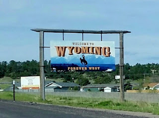
After two hours in Nebraska, I finally crossed into Wyoming where I spent the next 8 hours of my drive...
First, I passed through the capital, Cheyenne, population 62,000, and the former supply depot for Union Pacific during the construction of the transcontinental railroad. The building is made of sandstone. I crossed into the Mountain Time Zone and also crossed the Continental Divide during the morning, elevation 7000.
I drove through the Medicine Bow Forest to Laramie, population 30,000, and home of the University of WY. The city, originally a lawless rough town, was named for French Canadian fur trapper Jacque Laramie. In March 1870, five Laramie residents became the first women in the world to serve on a jury. As Laramie was the first town in Wyoming to hold a municipal election, on September 6, 1870, a Laramie resident was the first woman in the United States to cast a legal vote in a general election. Laramie and Rawlins both have historic frontier prison museums worth touring.
From there, the terrain changed dramatically every hour or so... first windmills, then rock formations and then pine forests and red clay:

In Sinclair, I passed Fort Fred Steele, built in 1868 by the Union Pacific Railroad to protect the construction workers from Indian attacks. I drove through avalanche areas, then dry scrubby plains and snow capped peaks:
After 5 hours driving along I-80W, I gassed up in Rock Springs and turned north, taking 191 up towards Jackson (3 hours). More spectacular scenery starting with wide, flat open roads and then the deep Hoback Canyon with a meandering river and steep winding roads. Along the way, near Farson and the Eden Valley, there were tiny old log churches and numerous historic markers for Pony Express stations, and Mormon and Oregon Trail sites.
Apparently this area is full of wildlife. Deer crossing and big game crossing signs were posted every 5 miles or so with bright orange flags. I finally got to see one of the "new" overpasses being used to protect migrating wildlife from cars. For centuries, migrating herds have used virtually the same paths to move from one area to another seasonally. By tracking places with high collision occurrences, wildlife biologists determined where to put these special wide grassy overpasses... and the herds actually use them to cross highways! I got my first view of the Tetons after emerging from one of these overpasses!
Next stop... Jackson, WY! Jackson is the actual town, and "Jackson Hole" is how they refer to the valley nestled below the Tetons.
All in all, an amazing day of non-stop, ever-changing, spectacular scenery. I finally arrived at the ranch at 4PM... more to follow soon!


No comments:
Post a Comment